

Compass

Compass açıklaması
A compass is a navigation instrument with a free rotating needle that indicates the direction of magnetic north.
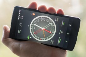
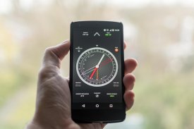
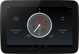
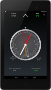
Most people know how to find the north using a compass. Few know how to use it as a navigation tool. The ability to navigate with a compass and a map is one of the most useful things to know while hiking. This compass app is not just a simple north direction indicator but is intended to be used as a real orientation tool for hiking activities.
Prerequisite: Your device must have an integrated compass sensor to function properly.
Highlights:
+ Orienting compass functions
+ Suitable for camping, hiking, and other outdoor activities
+ HD graphics
+ Quick step by step use guide
Features:
+ Rotating bezel
+ Rotating orienting arrow
+ Adjustable magnetic declination
+ Fine tune of the rotating bezel
+ Fine tune of the orienting arrow
+ Clinometer
+ Flashlight
Before you start using your compass
Each time you open the compass, shake your device a few times around its three axes in order to improve accuracy.
If your phone or tablet is protected by a magnetized cover, remove it before using the compass.
To rotate the compass bezel or orienting arrow, place two fingers on the screen at the same time and perform a rotation gesture.
Adjust the magnetic declination
1. Find the current magnetic declination for your location.
2. Push the Set Declination button.
3. Set the magnetic declination by turning the orienting arrow. You can fine tune the declination by activating the Fine Tune mode.
4. Push again the Set Declination button to block the orientation arrow.
Reset the magnetic declination
For a rapid magnetic declination reset, press and hold the Set Declination button.
Orient a map
1. Adjust the magnetic declination if necessary.
2. Rotate the bezel so that the north mark aligns with the index mark.
3. Place the device on the map so that its edge aligns with the map longitude lines.
4. Rotate the device and the map together until the magnetic needle aligns with the orientation arrow. Now your map is aligned with the geographical north.
Take a bearing from a map
1. Orient the map.
2. Place the device on the map so that its edge aligns with your current location and the location you wish to travel to.
3. Rotate the bezel until the orientation arrow aligns with the magnetic needle.
4. The direction of travel arrow on the compass gives you your direction of travel.
Find where you are on a map
1. Look around and select two distant objects that you can identify on your map.
2. Mark the selected objects on the map.
3. Orient the map.
4. Aim the direction of travel at the first object.
5. Rotate the bezel until the orientation arrow aligns with the magnetic needle.
6. Place the device on the map and draw a line along its edge through the mark of the first object.
7. Repeat from step 4 for the second object.
8. The intersection of the two obtained lines gives you your approximate position. If you repeat the process with a third object, the intersection of the three lines will result in a triangle. Your approximate position on the map is inside the triangle.
Measure the slope of the terrain
1. Rotate the bezel so that the east or west mark aligns with the index mark.
2. Place the device on the ground, aligned with the greatest slope.
3. Read the slope value shown by the clinometer needle on the inner scale of the compass.
Bir pusula manyetik kuzey yönünü gösteren bir serbest dönen bir iğne ile bir navigasyon alettir.
Çoğu insan pusula kullanma Kuzeyi bulmaya biliyorum. Az bir navigasyon aracı olarak nasıl kullanılacağını biliyorum. Bir pusula ve bir harita ile yolculuk yapma yeteneğinin yürüyüş sırasında bilmek en faydalı şeylerden biridir. Bu pusula uygulaması sadece basit bir kuzey yönü göstergesi değildir ama yürüyüş aktiviteleri için gerçek bir oryantasyon aracı olarak kullanılmak üzere tasarlanmıştır.
Önkoşul: Cihazınız düzgün çalışması için entegre bir pusula sensörü olması gerekir.
Özellikleri:
Yönlendirme pusula işlevlerini +
+ Kamp, yürüyüş ve diğer açık hava etkinlikleri için uygundur
+ HD grafik
+ Adım kullanım kılavuz Hızlı adım
Özellikler:
Döner çerçevenin +
+ Ok yönlendirme Döner
+ Ayarlanabilir manyetik sapma
+ Döner çerçevenin ince ayar
+ Yönlendirme ok ince ayar
+ Klinometre
+ El feneri
Eğer pusula kullanmaya başlamadan önce
Pusulayı her açtığınızda, doğruluğunu geliştirmek amacıyla Cihazınızı üç eksen etrafında birkaç kez çalkalayın.
Telefonunuz veya tabletiniz manyetize kapak tarafından korunuyorsa, pusula kullanmadan önce bunu kaldırın.
, Pusula çerçevesi veya yönlendirme oku döndürmek için aynı anda iki parmağınızı ekrana yerleştirin ve döndürme hareketi gerçekleştirin.
manyetik sapma ayarlama
1. konumunuz için mevcut manyetik sapma bulun.
2. Sapma Ayar düğmesine basın.
3. yönlendirme ok çevirerek manyetik sapma ayarlayın. Sen İnce Ayar modunu etkinleştirerek ayar Sapma ince olabilir.
4. Tekrar yönlendirme ok engellemek için Sapma Ayar düğmesine basın.
manyetik sapma Reset
ve hızlı bir manyetik sapma sıfırlama basın için Sapma Ayar düğmesini basılı tutun.
Bir harita yönlendirin
Gerekirse 1. manyetik sapma ayarlayın.
kuzey işareti indeks işareti ile aynı hizaya gelecek şekilde 2. çerçeveyi döndürün.
3. haritada cihaz gelecek şekilde kenar harita boylam hatları ile hizalar.
Manyetik iğne yönlendirme ok aynı hizaya gelene kadar 4. birlikte cihaz ve ilk döndürün. Şimdi haritası coğrafi kuzeye hizalanır.
Bir haritadan bir yatağı alın
1. Orient haritası.
2. Harita üzerinde cihaz böylece onun kenar mevcut yere ve seyahat etmek isteyen konumu ile hizalar.
yönlendirme ok manyetik bir iğne ile aynı hizaya gelene kadar 3. çerçeveyi döndürün.
4. pusula üzerinde seyahat okun yönü size gittiğiniz yönü verir.
Eğer bir harita üzerinde nerede olduğunuzu bulabilirsiniz
1. Etrafına bak ve size harita üzerinde belirleyebilir iki uzak nesneleri seçmek.
2. Mark harita üzerinde seçilen nesneler.
3. Orient haritası.
4. İlk nesneye seyahat yönünü Amaç.
yönlendirme ok manyetik bir iğne ile aynı hizaya gelene kadar 5. çerçeveyi döndürün.
6. haritada Cihazı ve birinci objenin işareti yoluyla kenarı boyunca bir çizgi çizin.
ikinci nesne için Aşama 4'deki 7. tekrar.
8. İki Elde çizgilerin kesişim de size yaklaşık bir konum kazandırmaktadır. Bir üçüncü cisimle işlemi tekrarlayın, üç satır kesişimi üçgen sonuçlanacaktır. harita üzerinde yaklaşık pozisyon üçgen içindedir.
arazinin eğimini ölçün
doğu veya batı işareti indeks işareti ile aynı hizaya gelecek şekilde 1. çerçeveyi döndürün.
2. büyük eğim ile hizalanmış yere cihaz.
3. pusula iç ölçekte klinometre iğne ile gösterilen eğim değerini okumak.


